Over the past few days, we finished up our last major activity in New Zealand— hiking the Kepler Track. This is one of the eleven Great Walks in New Zealand — multi-day hikes featuring some of New Zealand’s most spectacular natural landscapes. To do these treks, hikers typically stay in backcountry huts, and bookings for some of these huts fill up fast, often on the first one day that the reservation system opens for the season. Indeed, we’d made our reservations in April, more than 8 months ago. Hiking the Kepler Track was the major reason we came back to New Zealand, as the huts were closed for the winter months when we were in New Zealand the first time.
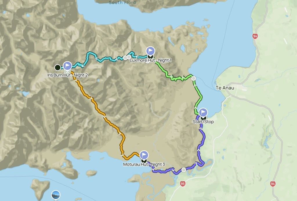
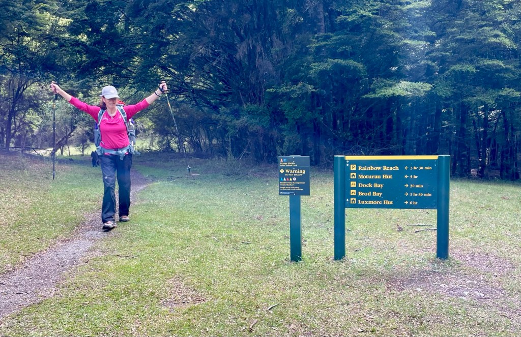
When you add in some short spur trails, the Kepler Track spans a little more than 38.5 miles with total elevation gain of about 7,500 feet. We planned to break the circuit into 4 days, hiking 9 to 10 miles each day. The map below shows the four sections we planned to hike going counterclockwise.
We spent the day before our departure preparing in nearby Te Anau. We rented gear from a nearby “shop” that was basically someone’s house. We bought freeze-dried meals at the grocery store, which was well stocked for hikers.
And we worried about the weather. For the prior week, the forecast had called for rain for our entire four-day hike, which isn’t a surprise as it rains about 200 days each year in the Fiordlands. In fact, it rained all day in Te Anau as we prepared. Rain and flooding had temporarily closed another nearby Great Walk – the Milford Track. Wind was also a concern. For a couple of days that week hikers had not been able to complete the Kepler Track due to 60 mile-per-hour winds and white-out conditions on some of the steep alpine sections.
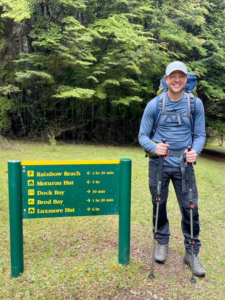
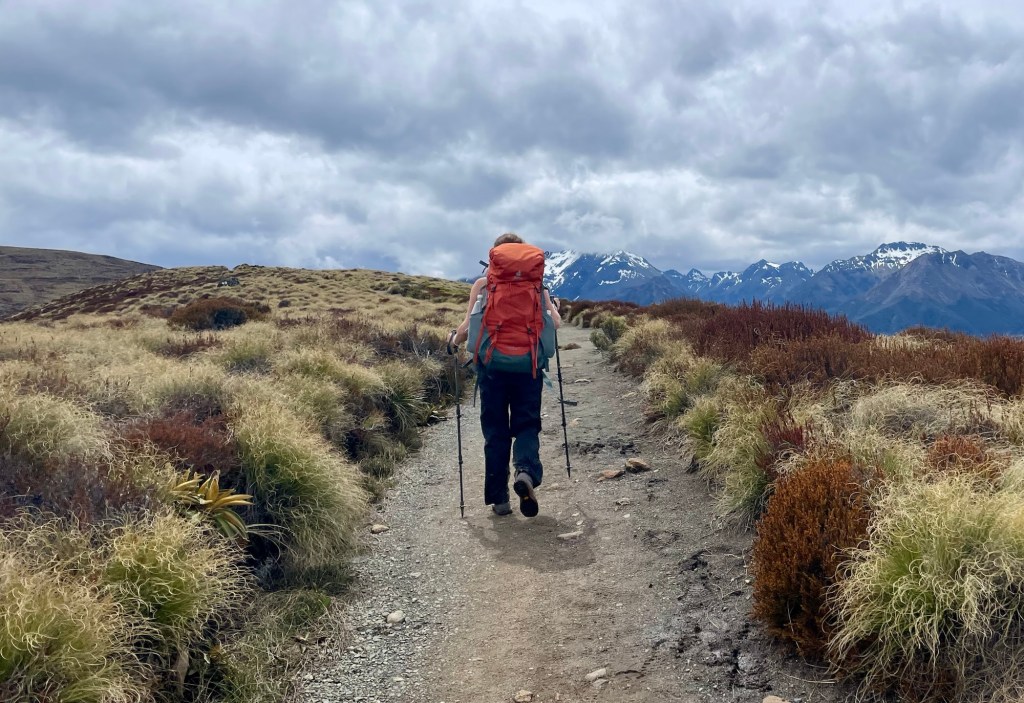
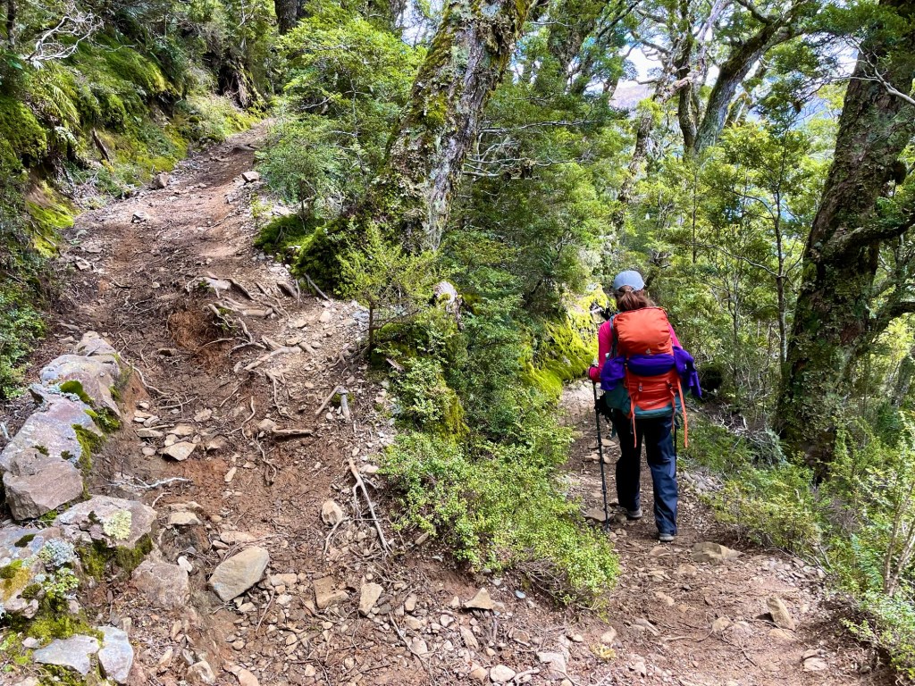
There’s a saying in backpacking that you pack your fears. Confirming that wisdom, we packed our clothes, food, and sleeping bags in multiple dry bags and plastic bags. On December 1, we stowed our luggage in lockers at a nearby campground and drove to the trailhead. By late morning, we hit the trail for the 6-hour hike to Luxmore Hut, the first place we’d be staying on the trail.
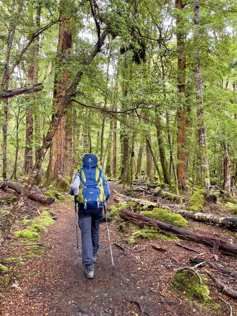
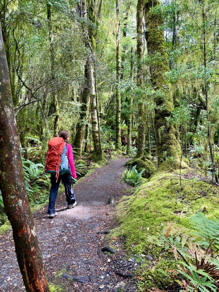
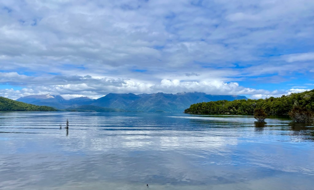
The trail started out relatively flat, as it followed the shores of Lake Te Anau, winding through red beech forests.
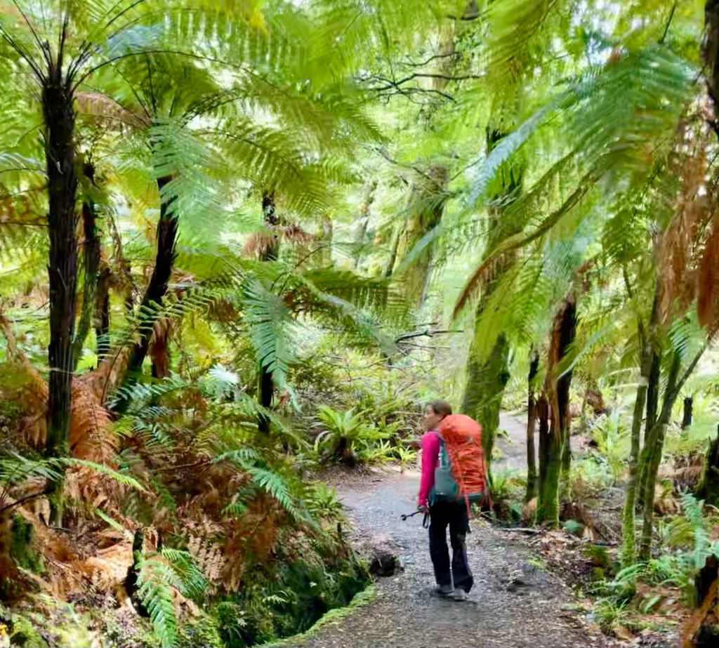
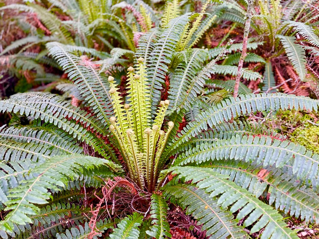
There were also huge stands of tree ferns.
It was great to be hiking in the Fiordlands again, and Julie and I were making great time.
After a couple of hours, we took a short break to take a look at the shores of Lake Te Anau. So far so good with the weather!

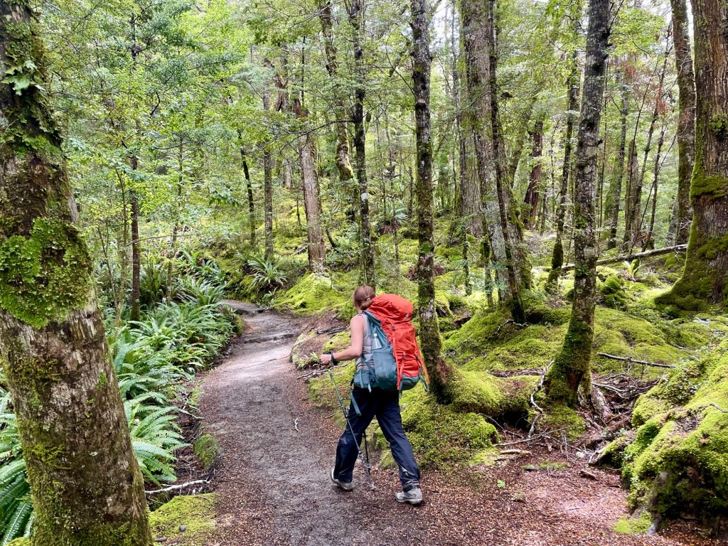
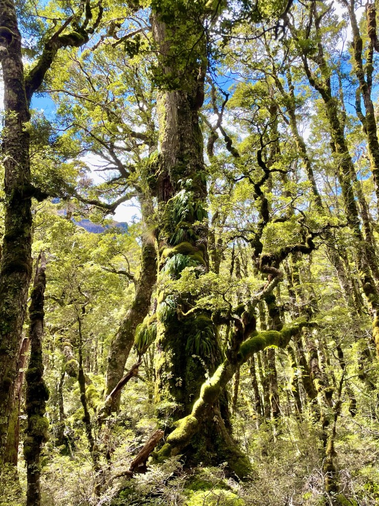
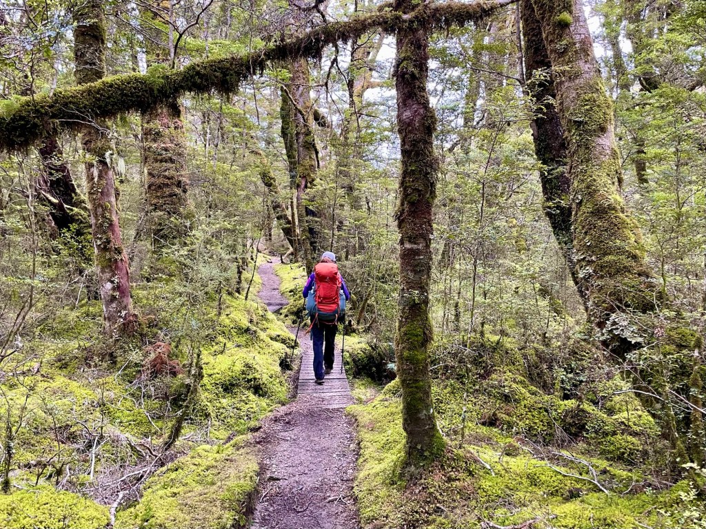
From here, the trail turned inland away from the lake and started to climb steeply, passing through old-growth trees with a fern-covered forest floor.
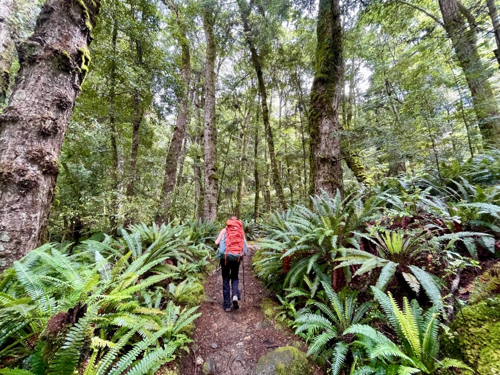
We also saw huge expanses of moss, a testament to the enormous of amount of rainfall in the Fiordlands.
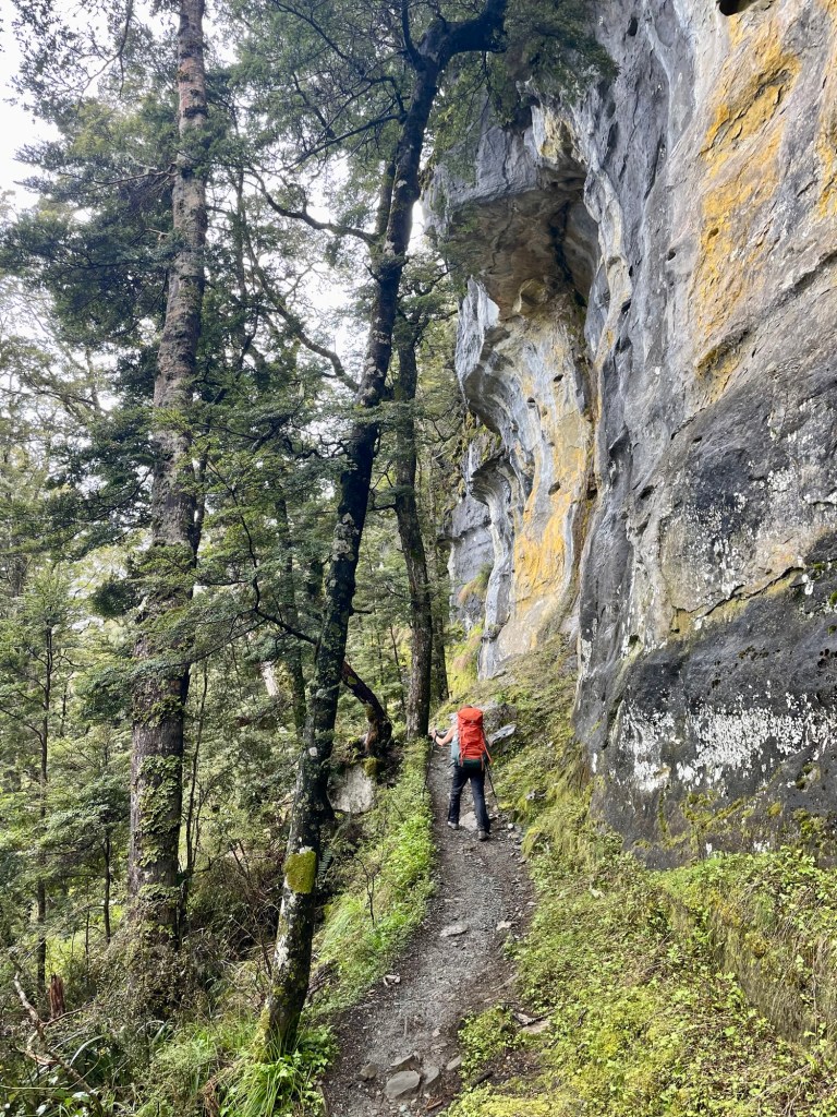
As we climbed, the landscape grew rocky.
Eventually, we emerged from the trees to the reach alpine grasslands.
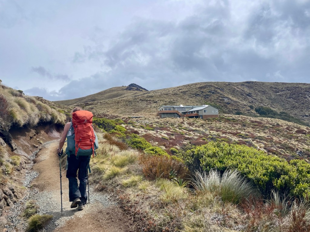
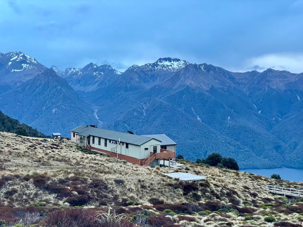
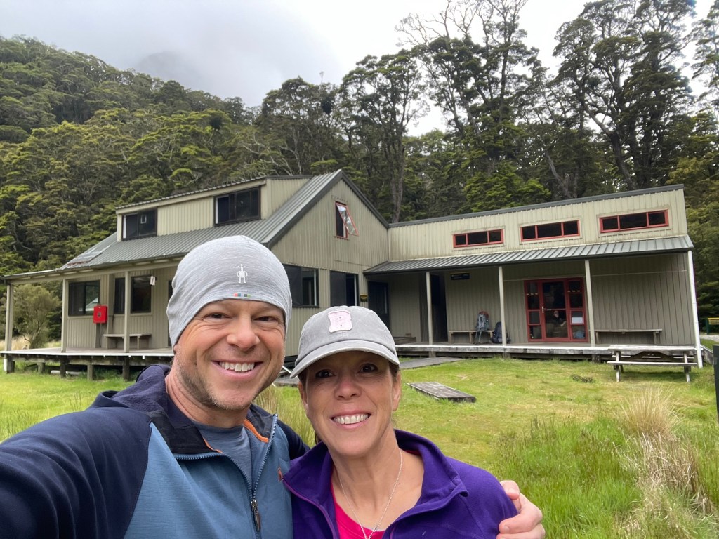
By late afternoon, we reached Luxmore Hut.
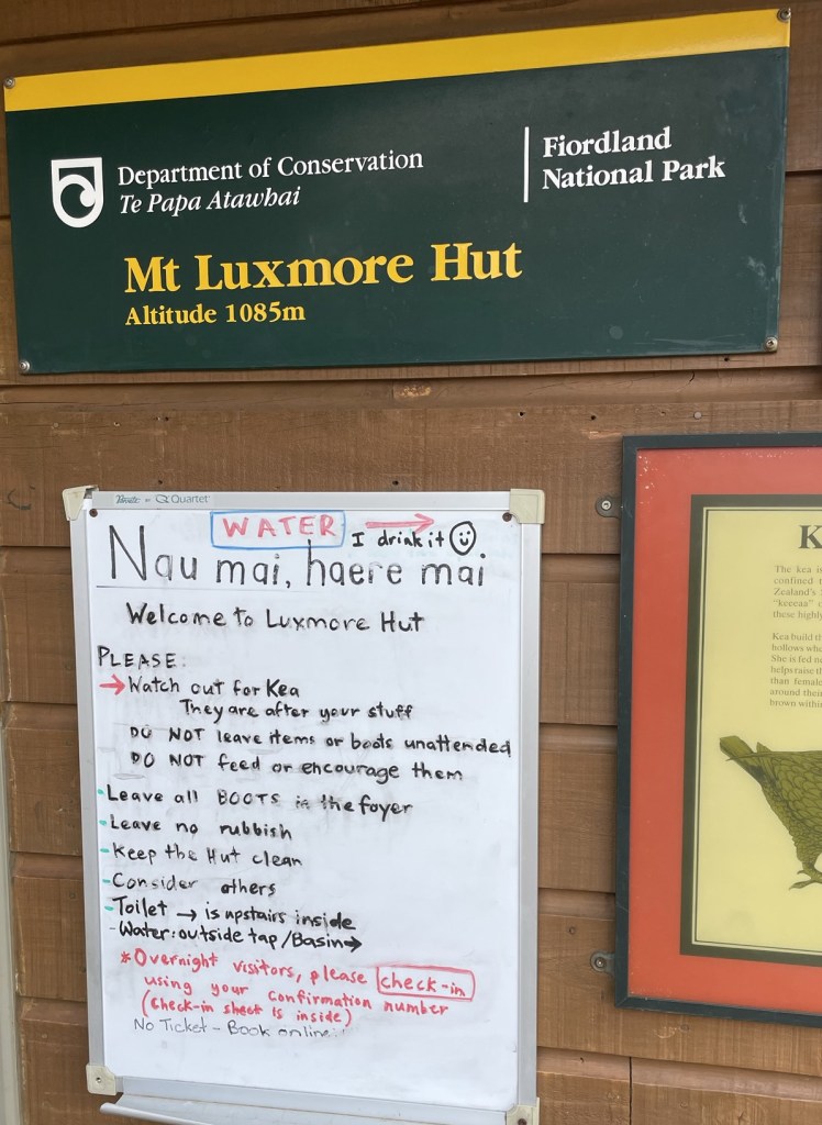
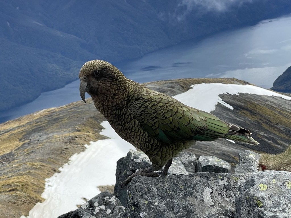
As we headed inside, we noted a warning about one of the major dangers in the the Fiordlands: keas. These alpine parrots are curious and clever, but they often investigate new things by ripping them apart with their sharp beaks. They are famous for destroying socks, boots, jackets, and other camping gear.
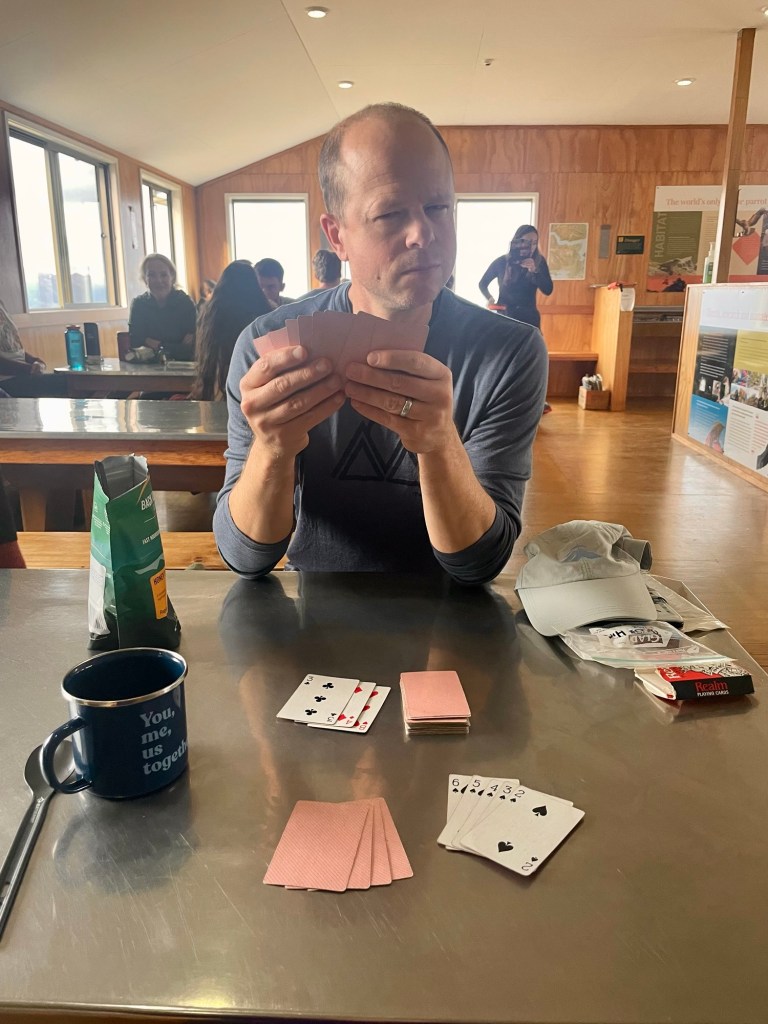
Once in the hut, we dropped our packs in the bunk room, made dinner, and found some playing cards. Julie destroyed me. Probably by cheating.
We also noted an avalanche safety warning.
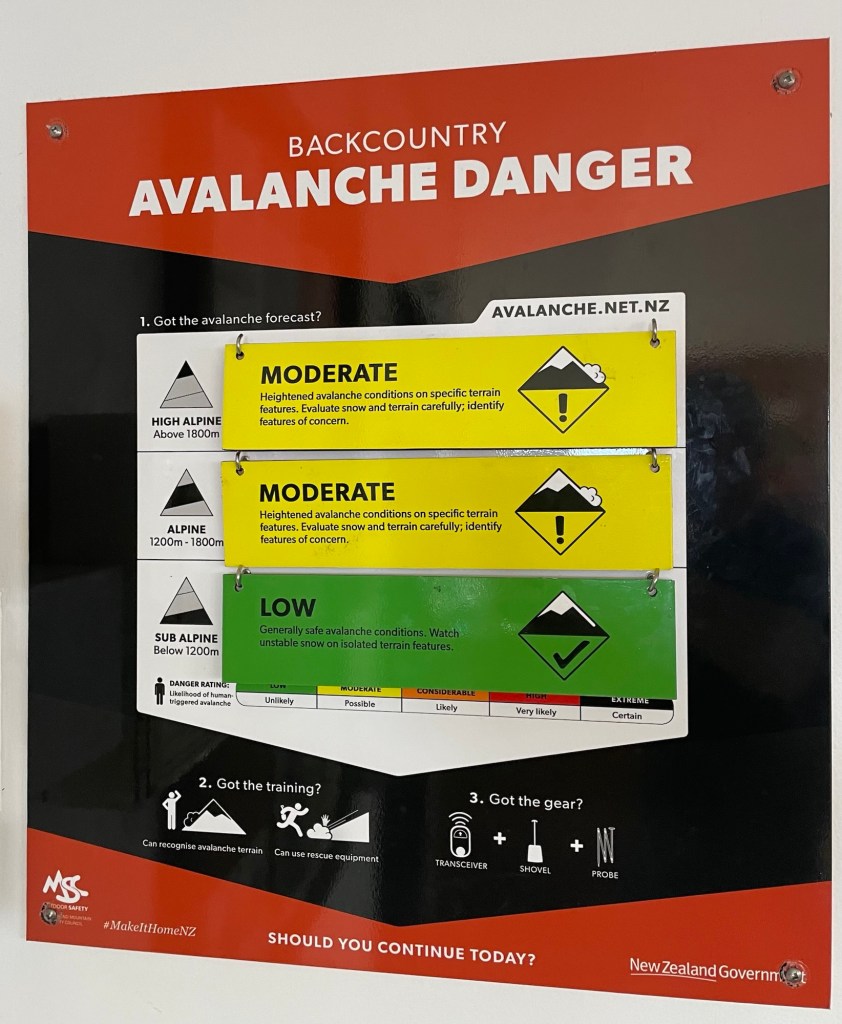
Only about 20% of our hike was in the alpine region where there was a moderate chance of avalanche. The rest of the hike was in the clear.
After dinner, we took a short walk to the nearby Luxmore Caves. We didn’t go in because it was filled with rushing water, but the high alpine walk in the dying light was great. Plus, we had a nice view of Luxmore Hut on our way back.
We were tired, but I can’t say we slept particularly well. We were in a bunk room with 8 mattresses side-by-side on a large “lower bunk,” and another 8 mattresses above them in a loft space. Eye masks and ear plugs can only do so much.
Fortunately, we woke up to beautiful views. After a quick breakfast of oatmeal and instant coffee, we were ready to set off for day two. As we were lacing up our boots outside, we faced off with one of the local troublemakers, an inquisitive kea named Nibbles.
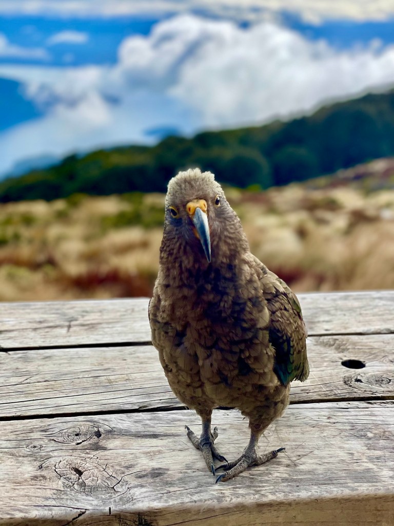
True to his name, this dink-toed menace tried to get into to any piece of our gear that we left unattended.
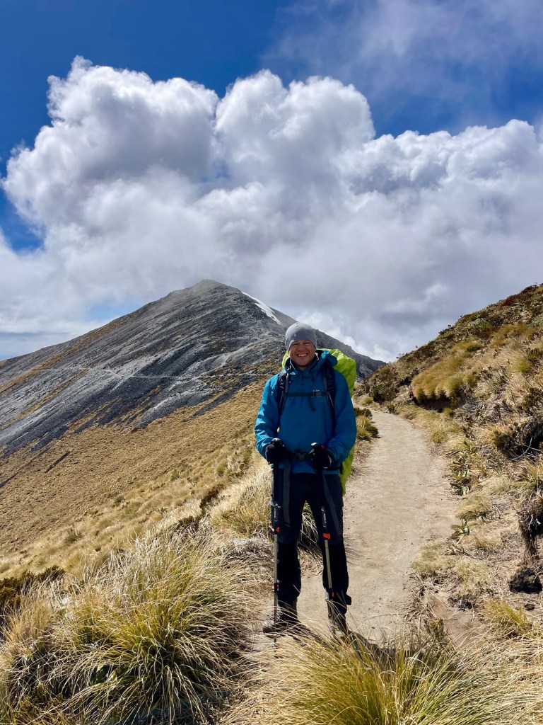
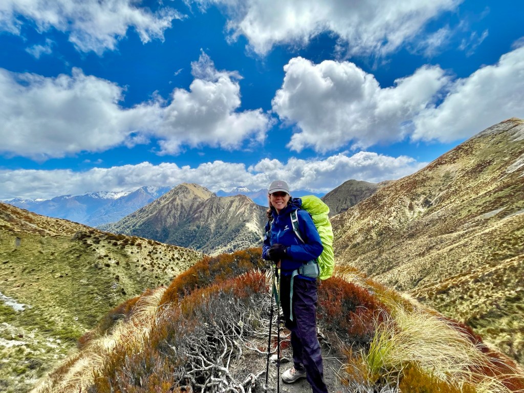
With Nibbles’s blessing, we headed off, climbing steeply, hiking through snow in one section. We encountered some light rain, so we put on our coats and the rain covers for our packs. But the rain showers were very light and very brief. We soon reached a spur trail to the summit of Mount Luxmore.
We had to take our packs to the top out of fear of mischievous keas. We had great views from the top back towards Te Anau. We’d started our hike just under 700 feet above sea level, while Luxmore stands at 4,829 feet.
And, in fact, there were keas ready to start shredding anything that looked interesting.
The clouds came and went rapidly on the summit, with a little bit of snow and sleet coming down. Having had our fill of the views, we headed back down to the Kepler Track and continued onward.

After a bit, we paused to look back at Mount Luxmore and our trail skirting below the peak.
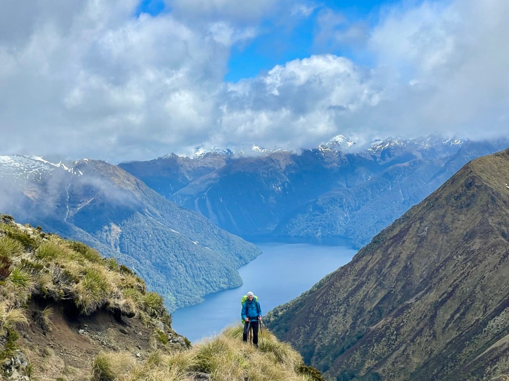
The trail roughly paralleled the South Fiord of Lake Te Anau, so that we frequently had amazing views of the water with the mountains of the Fiordlands stretching in the distance.
The video gives a little better sense of the scale of the steep ridges.
Great views in every direction!

And the weather just kept getting better.
We passed one spot that was a dead ringer for the winding staircase from LOTR.
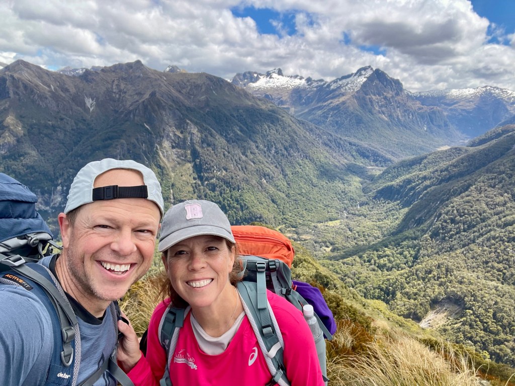
We stopped for lunch at what is probably the finest picnic spot I’ll ever see.
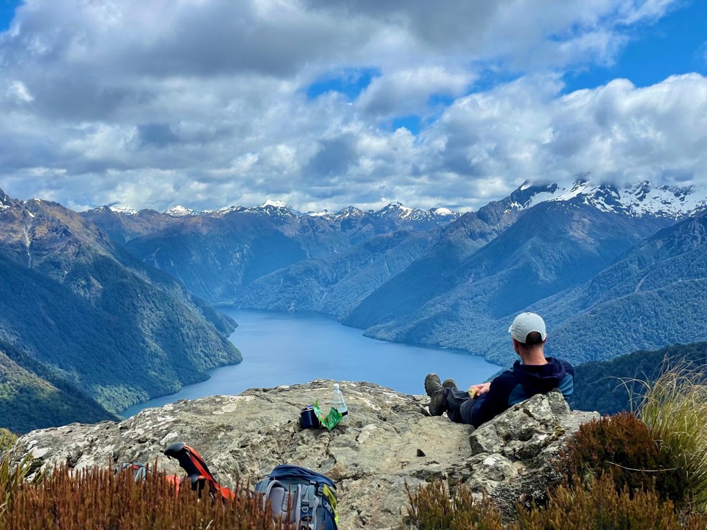
Refueled, we continued on.
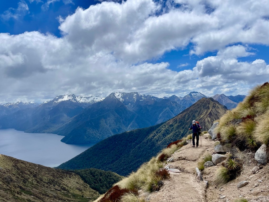
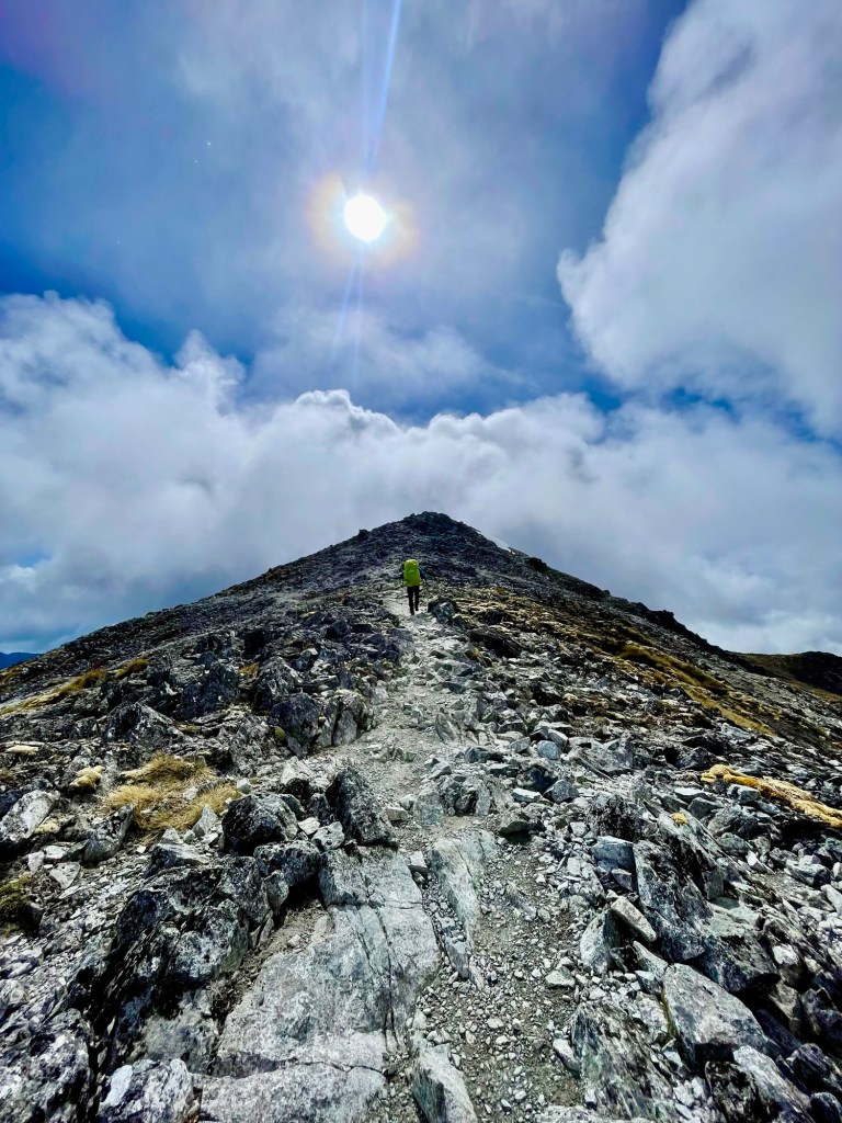
Having skirted various peaks for a while, we reached a section where the trail traced the top of blade-like ridge.

We could see the trail extending along the ridge far into the distance.
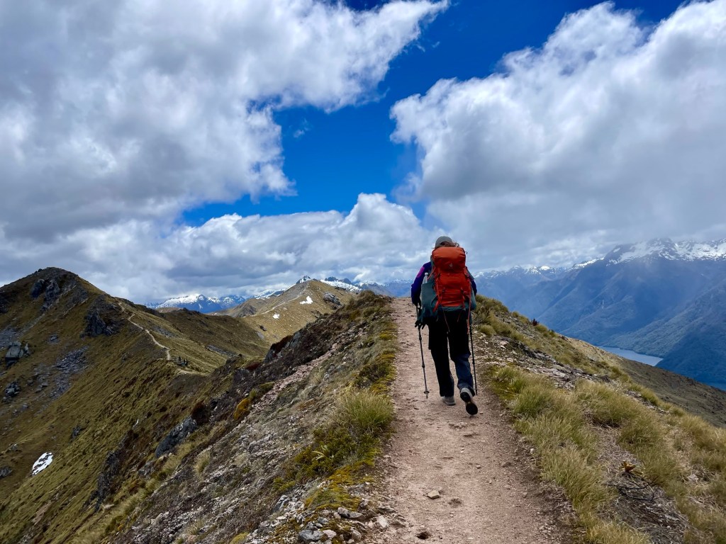
With no trees, we could see the Kepler Track arcing miles in the distance to the far side of the ridge.
We stopped for a quick break at what might be the prettiest backcountry toilet in the world (not featured). Bonus! There were other hikers there, so we got a picture together.

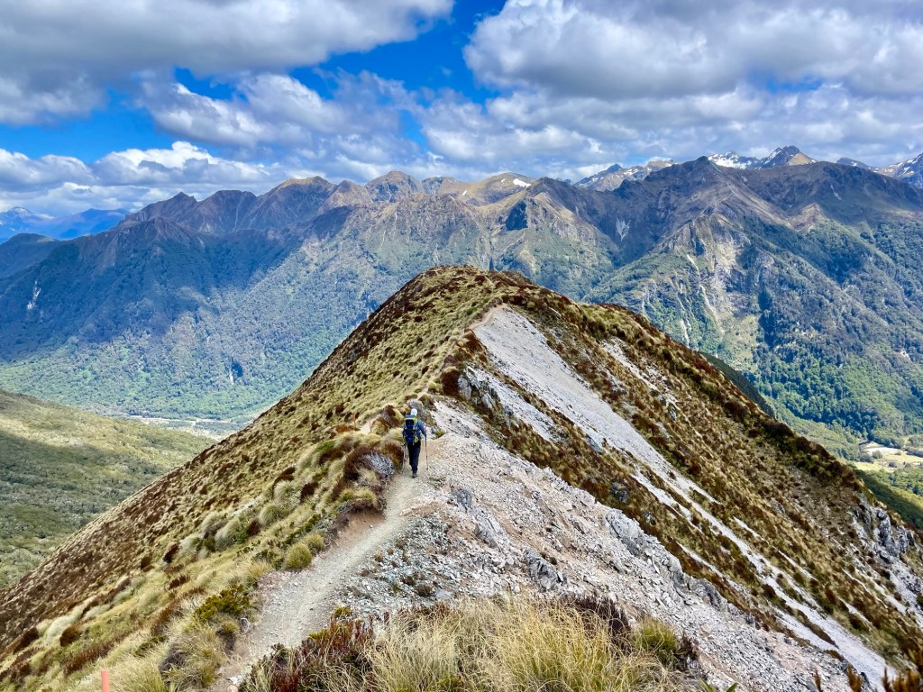
We continued along the descending ridge. Because space at the huts is limited, there were surprisingly few people on the trail, particularly given how spectacular the landscape was.
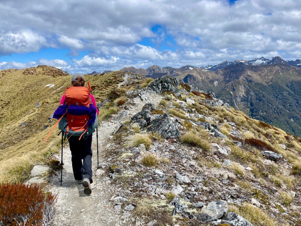
We started dropping elevation fast. Part of me wished the trail would just continue along some of the other high-alpine ridges we could see stretching in the distance, but I suppose all good things must come to an end.
Eventually, we took a spur trail to the final lookout before a steep descent back below the tree line. In the distance we could see a clearing (above Julie’s left shoulder), which we’d later realize was our hut for the night. We could also see a white smudge (further above Julie’s left shoulder) that we’d later realize was Iris Burn Falls.
From here, the trail rapidly descended with steep switchbacks. Note the trail on the left is above Julie’s head.
We were once again in lush forests of trees covered in moss, lichen, and new growth.
We finally reached the Iris Burn Hut very tired but elated with the day’s hike.
After dinner, we took a short walk to see the Iris Burn Falls. You know, because we hadn’t walked enough today.
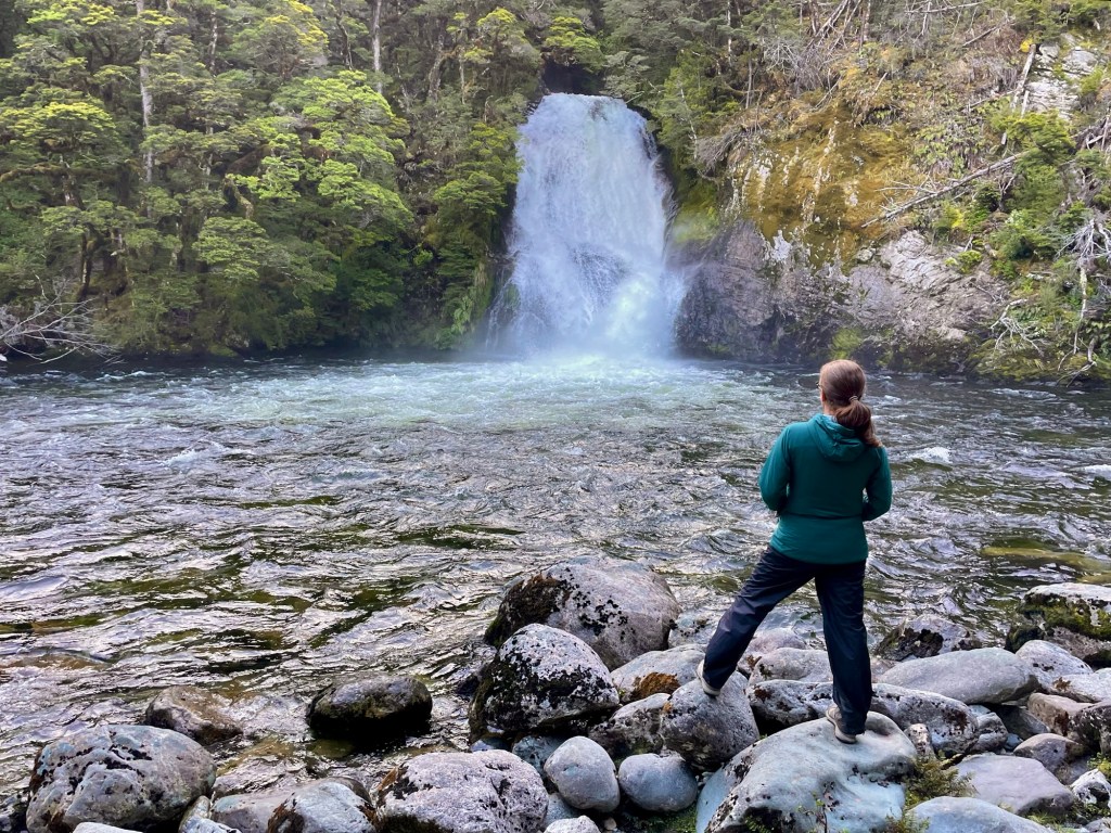
The falls were beautiful, and walking without packs was refreshing. On our way back we saw a whio, a type of rare Fiordland duck that lives in swift waters and eats various critters that live under rocks in streams.
Whios are fairly rare, with only about 3,000 remaining in the wild. Keas are also rare, with estimates for their numbers ranging from 3,000 to 7,000. For comparison, there are about 70,000 kiwis in the wild, but we didn’t see any because they’re nocturnal. And apparently scared of everything. Maybe that’s why they’re doing better.
We headed back to the hut, where Julie and I had picked a bunk room with only 8 berths. We each had a top bunch, but we hoped that the smaller number of people in the room might help us sleep better. Some of our roommates had other ideas, as they started getting packed up the next morning around 4:30 am. With their help, Julie and I also got a very early start and were on the trail around 7:30 am.
The trail followed the Iris Burn down the valley. Small streams fed into the creek, including some water falling from great heights.
Along the trail, we again enjoyed seeing ferns exploding with new growth.
The incredible amount of rainfall in the area also supported massive carpets of thick moss.
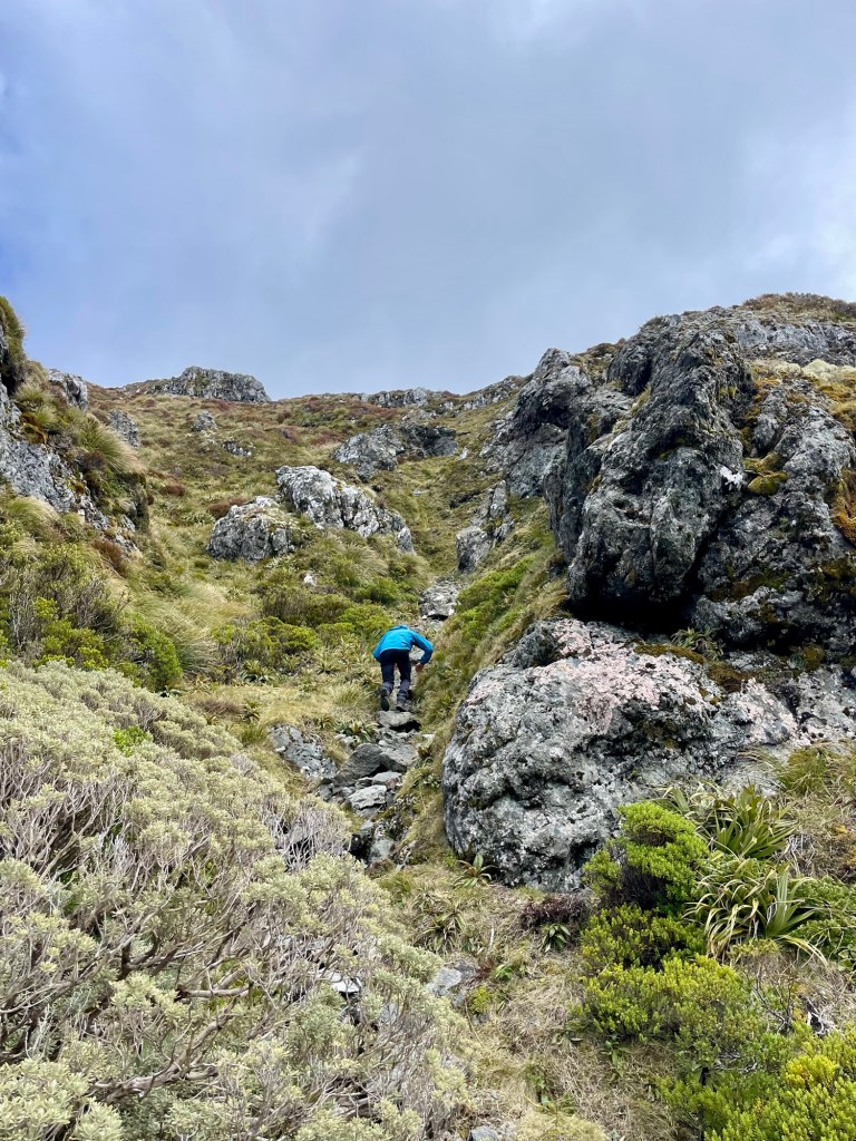
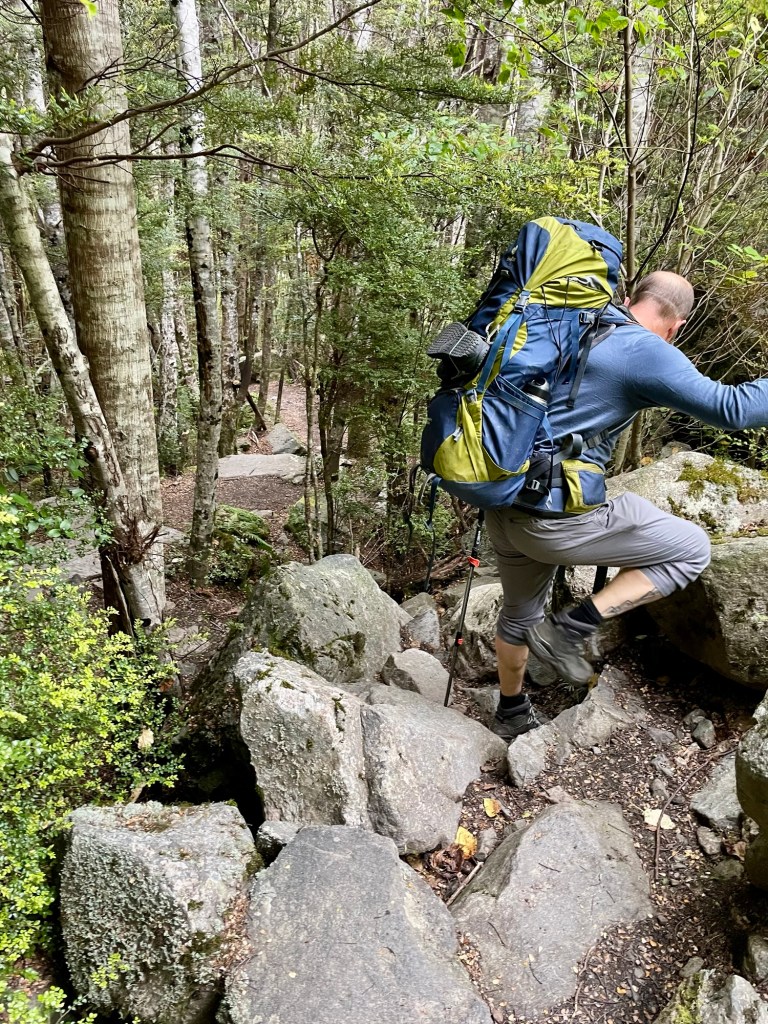
In some sections, we had to scramble down rocks, but overall the trail was relatively flat compared to the extremes of the previous two days.
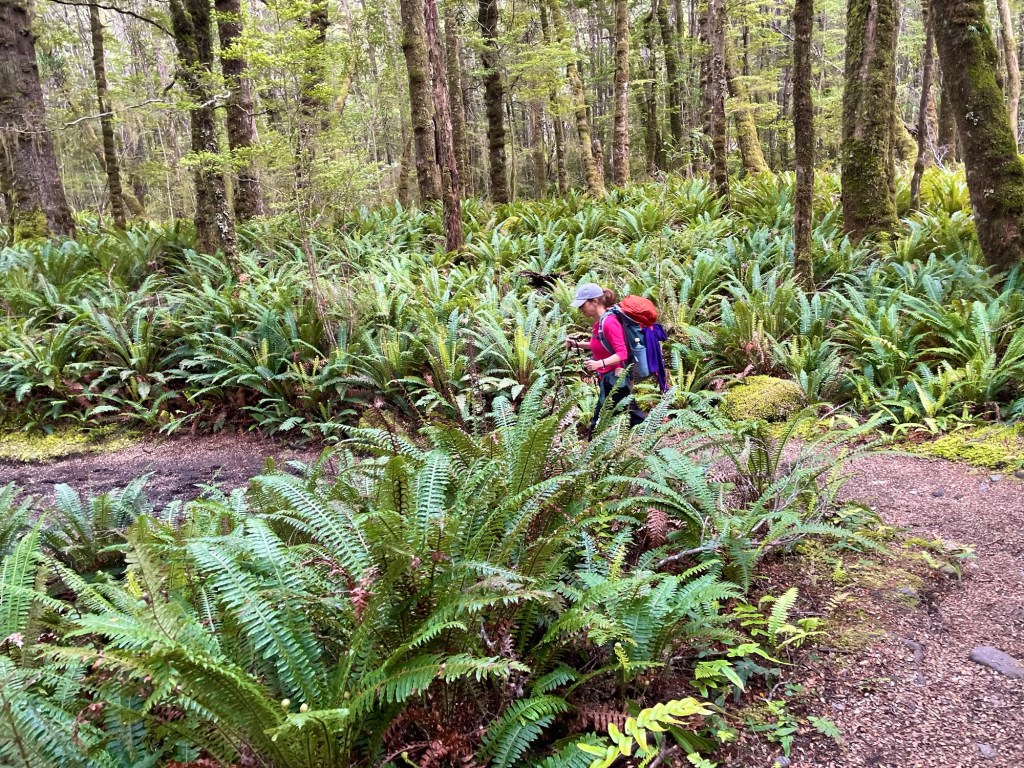
For some stretches, huge expanses of ferns stretched into the distance underneath the canopy.
Massive red beech trees stood high above us, though some had fallen to the powerful winds of the Fiordlands.

The sound of the the river grew as more and more streams fed into it, but finally fell silent when we reached the stillness of Lake Manapouri.
Around noon, we reached Moturau Hut, where we planned to spend the night.

This presented us with a bit of a quandary. Between the shallow descent and our early departure, we’d reached our destination much earlier than we’d initially planned. Julie and I decided that it made more sense to push on, combining our third and fourth days of hiking into one 20-mile day.
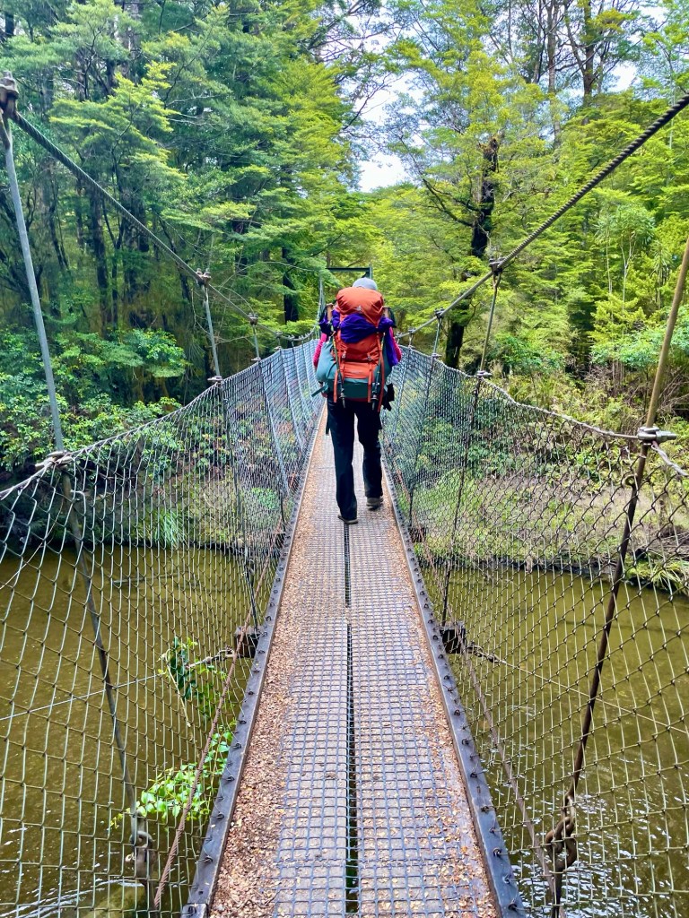
Shortly after the hut, we crossed our last suspension bridge in New Zealand.
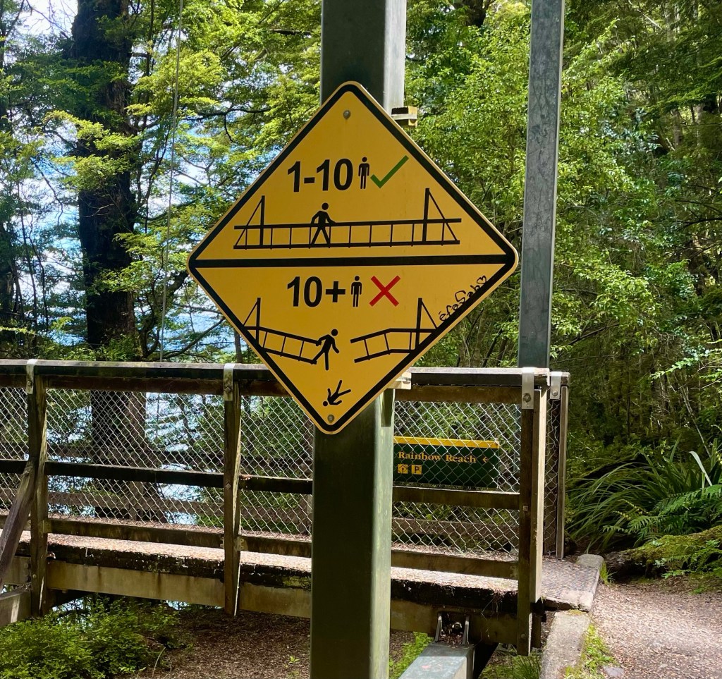
The next 10 miles were a combination of determination and delirium. We enjoyed the hike, but we tried not to stop for photos. We couldn’t resist taking a picture of this sign, no doubt the work of exasperated civil engineer.
After about 10 hour of hiking, we finished!
We headed back to Te Anau, returned our camping gear, and picked up up our luggage. We then drove a couple of hours to Queenstown.
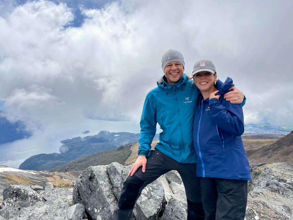
By 9 pm, we were in our AirBNB. This is the last place — and the 54th place — we would stay on our 6-month odyssey. We ended the night drinking one of our favorite Queenstown beers, Mischievous Kea, and toasting to Nibbles. We were sore, exhausted, and exhilarated!
-Will

You two are the cutest and SO inspiring! We need a dinner so we can hear all about your 6 months!! Hugs and safe travels home. 💕💕
LikeLike
We did the much easier but almost as scenic Milford Track many years ago. I’d bet our trip included a toilet view as least as beautiful as yours. The world just doesn’t get prettier than New Zealand, especially South Island, does it?
LikeLike