We started Day 7 a little slowly with breakfast and coffee at a small cafe in Corralejo that looked out at the ocean. Once fueled, it was time to get going.

Our first destination was La Playa de Tebeto – Tebeto Beach. One of the charms of Fuerte ventura is that it is riddled with hidden beaches. We picked Tebeto largely at random but were excited to see what we could find. With Guille and Diego as our guides and compatriots, we set out. After about 30 minutes, we ran out of paved road. Things were getting good!

When the dirt road ended at the edge of a cliff, we parked (rather than driving into the ocean).

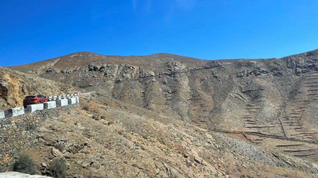
Looking back on the road where we had been driving provided another great example of Fuerteventura’s arid, volcanic landscape. A ravine to the north appeared to lead to the beach so we headed down.
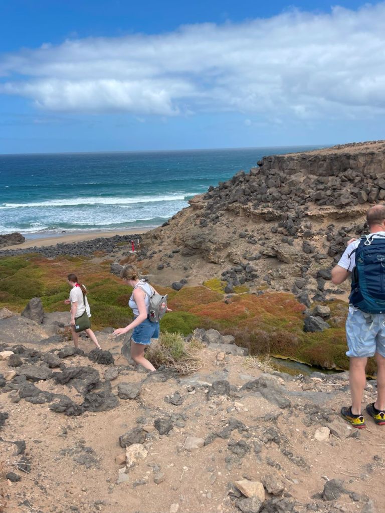
A tiny streamlet sprang from the rocks, providing more natural greenery than we had seen anywhere else on the island.

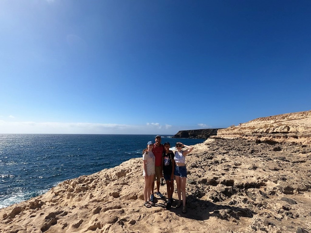
We continued on to the beach, where we discovered a small wooden sign that confirmed we had found the right place. There was also a life preserver in case of emergencies, but I couldn’t decide if that was reassuring or ominous.

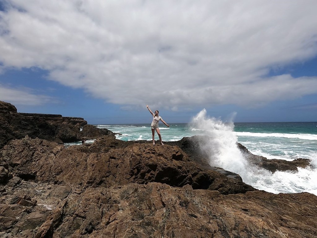
The waves were too big to swim comfortably, and the water was a little chilly as well. So, we spent our time scrambling on the rocks and exploring small pockets of water, starting with a “fuerte on Fuerteventura” shot.

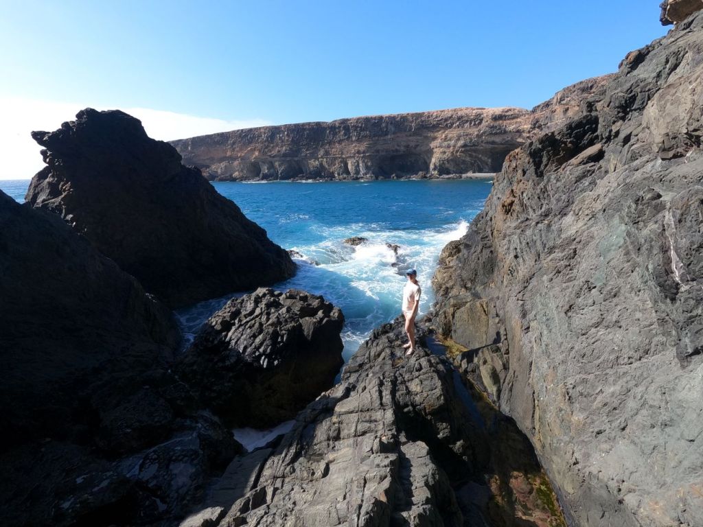
We could see waves crashing on some particularly intriguing rocks at the southern end of the beach, and we decided to explore further.
The rocks in this spot were covered in small pools fed from waves crashing over the rocks. From here, Lydie and Cassie split up. Cassie set off to get closer to the edge, where the waves were crashing (somewhat to her mother’s dismay).

Success! Cassie managed to get sprayed by a few waves without being swept out to sea.
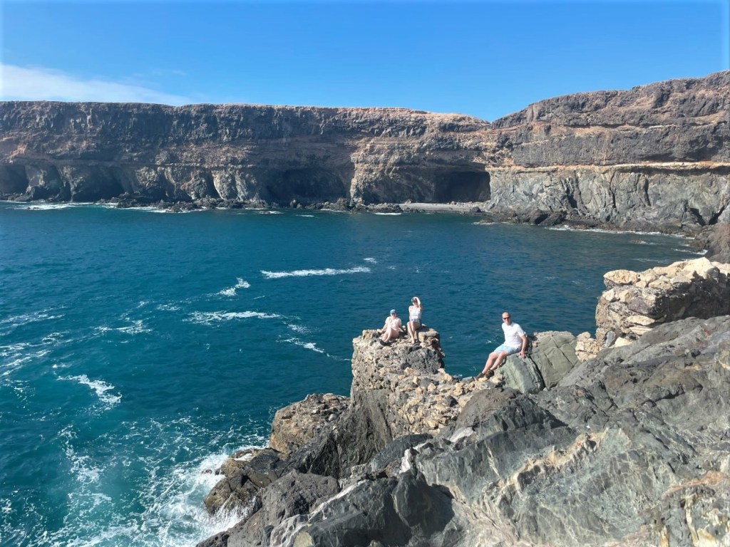
Meanwhile, Lydie wanted to explore the small cove behind the rocks that Cassie was climbing.
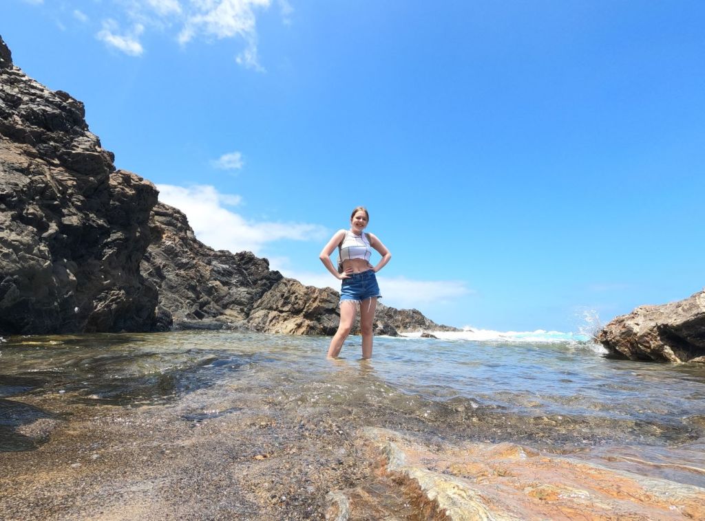
Lydie scrambled up some of the rocks to get a better view.

Guille likewise enjoyed scrambling among the rocks while looking in the pools for snails and crabs.

Tebeto was beautiful, but it was time to be moving on. We scrambled back up the ravine, cleaned off our feet, and piled back in the cars. Our next stop was Betancuria, a small village nestled in the highlands of central Fuerteventura. Betancuria is named for Jean de Béthencourt, a French explorer who helped to conquer the Canary Islands between 1402 and 1405. Béthencourt founded Betancuria in 1405 as the original capital of the Canary Islands. The area is one of the lusher parts of Fuerteventura, at least compared to the rest of the island. We arrived hungry, and soon spotted a cafe.

Inside, we were delighted to find expansive trees offering cool shade.
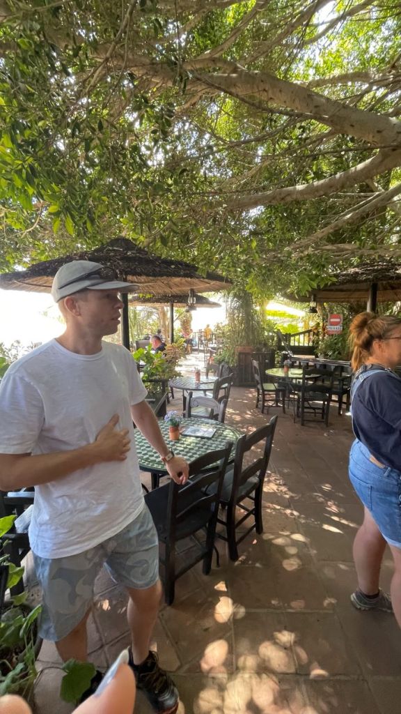
We had a great albeit late lunch and particularly enjoyed the local cheese, Majorero. This is a goat cheese, as goats are tough enough to thrive in the harsh climate of Fuerteventura. In fact, there are more goats than people on the island. Majorero is a bit like Manchego. The name comes from “Mahorero” comes from the language of the local Guanche people, who were the natives of the Canary Islands when Béthencourt arrived around 1400 and conquered them. The Guanche language is now an extinct language, but some terms survived. “Mahorero” was the word used today to describe the people of Fuerteventura. It’s a bit of a dark etymology for a cheese name. But the cheese was delicious. While we waited for our food, we relaxed and played cards.

After lunch we enjoyed walking around the town, which is dominated by a Iglesia de Santa María, a church that dates to 1620.

Recharged, we continued sought from Betancuria toward Pájara, in part because the high mountain road between the two towns was supposed to be beautiful. And it certainly was!

We were glad to have Diego in the lead on the steep road, so that we could pay a little more attention to the scenery.
But we were not alone in the high desert mountains. The goat patrol was out in force.

In fact, Fuerte Ventura is home to a special breed of goat – the Cabra Majorera – which is particularly adept at surviving in the dry climate. We soon reached Pájara, but were just passing through. Our next destination was the costal village of Ajuy, as we had read that there was a cave of some sort. We reached the town, parked the cars, and set out on a coastal path.
After a short hike, we reached the caves. We really didn’t know what to expect, as we had learned of the cave from a brief mention in a guidebook. These might be some small little caves in the cliffs. Nope. They were huge.
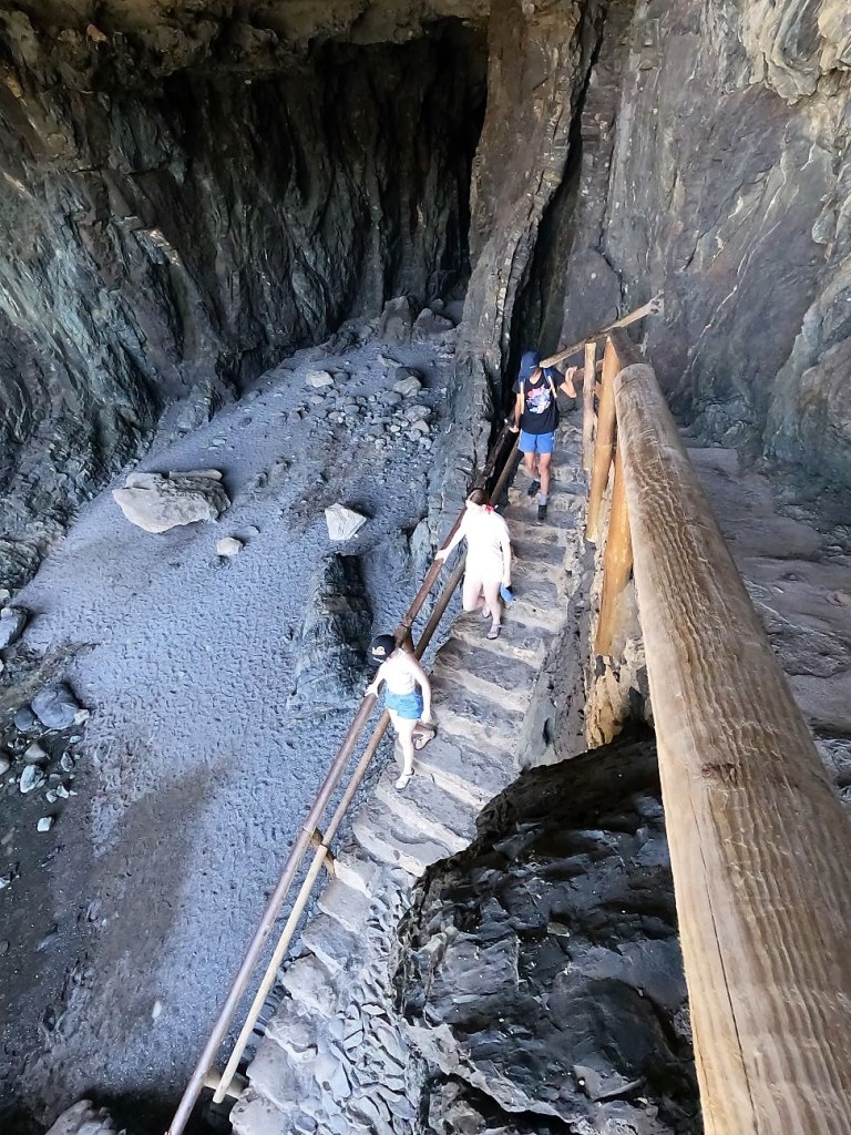
The caves are actually manmade, leftover from mining, which was used to make lime. The massive tunnels extended far back into the rock.

After exploring the tunnel a bit, we were delighted to find a large rift that lead to another cave.
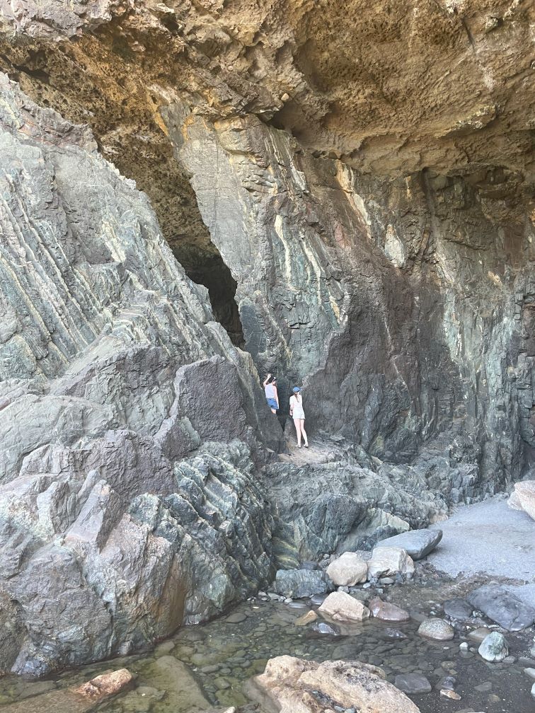
Naturally, this one had to be fully explored as well.

By which I mean fully explored…

After plumbing the stygian depths, we returned to the entrance to the cave to scramble up the rocks. Across the water we could see additional caves, likely also made by limestone extraction.
Finally, we climbed out onto the ruins of a landing platform once used to load lime onto boats. Between the crumbling rocks and the crashing waves, it was super safe.
By the time we finished exploring the area around the caves, it was time to head back to Corralejo, where we reunited with the rest of our Spanish friends for dinner. Most of shared a local specialty – an entire fish cooked in a thick layer of salt.
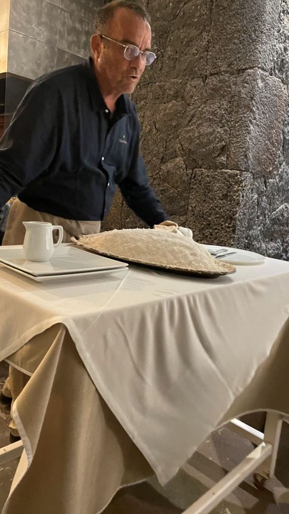
The fish was delicious, as the salt crust sealed in moisture. We went to bed tired and full. It had been a day filled with activity and exploration, just the way we like it.
-Will
